Andebit et beaqui corendit, ut quostes esciendion re dit ad et prae parion es quia quas alibus sam, omnim faciden ducipidiat arum autem nobis enis es voat

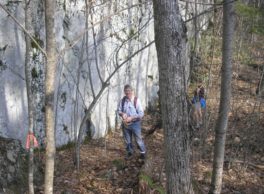
Boquet Mountain Trail

North trailhead on Jersey Street. (County Route 12) 1½ mile west of Boquet River. Trail goes up to the saddle between North and South Boquet Mountains, traverses east side of South Boquet Mountain and continues on old logging road to south trailhead on Cook Road* about ¾ mile west of Leaning Road. Distance And Terrain
5 mile round trip, easy
Identify And Describe The Management Organization
Champlain Area Trails
Additional Notes
*Cook Road closed during the winter- dates depending on snowfall, typically from December to March
Fees
no
ADA Accessible
no
Tours Are Offered
yes
Site is Child-friendly
yes
Site is Pet-friendly
yes
Comments
good post
rathu, 2/15/2016
Location
Downloads
NearBy
Chris Maron - Champlain Area Trails
518-962-2287
PO Box 193
6482 Main Street
Westport, NY 12993 US
[email protected]


