
Andebit et beaqui corendit, ut quostes esciendion re dit ad et prae parion es quia quas alibus sam, omnim faciden ducipidiat arum autem nobis enis es voat

Lake Champlain Blueway Trail: Valcour & Crab Islands: Introduction
Take the Journey in one of two ways:
1. Navigate to Site 1
2. Listen to our audio tour
Download Lake Champlain Blueway Trail:
Valcour & Crab Islands Audio (.Zip 615.63MB)
What to Know Before You Go
The Valcour & Crab Islands PassagePort is designed to be used by canoeists and kayakers, and other interested boaters, as a recreational water path. Accessible only by boat, Valcour and Crab Islands are located offshore from the Towns of Peru and Plattsburgh. The PassagePort identifies points of interest such as launch and landing points, marinas, where to park your car, potential hazards or challenges, natural areas and wildlife viewing, camping locations, museums, and communities with nearby food, lodging and shopping. In addition, the Valcour & Crab Islands PassagePort presents the rich cultural, historic, and recreational opportunities on the islands and around Lake Champlain.
Valcour Island is state-owned and located approximately a half mile offshore from the Town of Peru. Valcour Island offers camping, hiking, fishing, bird watching, and rock outcrops with many Ordovician fossils. Valcour Island forms a narrow strait against the mainland shores of Peru and Plattsburgh, a geographic feature that can cause hazardous weather conditions for boaters. Valcour was the site of a pivotal naval battle during the Revolutionary War. In the fall of 1776, the narrow strait offered a strategic haven for the American fleet during the Battle of Valcour Island. Craggy outcrops, sandy beaches, and protected bays make for a varied shoreline. The picturesque Bluff Point Lighthouse dating to 1874 stands on the western shore facing the Peru boat launch. Although decommissioned in 1931, the lighthouse was restored in 2002 and is now fully functioning.
Recently, Valcour Island was designated by the National Park Service as part of the 450-million-year-old Chazy Fossil Reef. The Chazy Reef was formed in a tropical sea far to the east of where Zimbabwe, Africa, sits today. As continents moved across the globe millennia ago, the reef collected a plethora of sea creatures that became fossilized.
Crab Island, originally called Ils St. Michel, is located off the western shore of Lake Champlain near Cliff Haven in Plattsburgh, about 1.3 miles North of Valcour Island. Crab Island takes its name from the fossils of ancient shelled creatures, called trilobites, found in its limestone shoreline. This roughly 40-acre island was once a significant site in the Battle of Plattsburgh. The island served as a military field hospital for both British and American soldiers during the final battles of the War of 1812 and became the final resting place for 149 American and British sailors. The island has a network of trails, granite obelisk and a 100-foot flagpole flying the American flag with 15 stars on it.
This mobile-enhanced tour of Valcour and Crab Islands draws from the views and experience of local people, with the understanding that “The Best Travel Advice Comes from the People Who Live Here.” This project was made possible with the help of h istorians, experienced paddlers, and others knowledgeable about recreational activities on Lake Champlain. The audio tour presents detailed information on history and paddling from Kevin Kelley, supported by the research of Roger Harwood in conjunction with the Clinton County Historical Association. Morris Glenn, an historian who has thoroughly researched the region’s history, provided information on historic landings. James P. Millard has written extensively about the history of Lake Champlain, including Valcour and Crab Island. Andrew Sajor, an expert on developing educational outreach programs, assisted with details and offered stories about winter adventures on Lake Champlain. Extensive advice about exploring and paddling around the islands can be found in the book, A Kayaker’s Guide to Lake Champlain: Exploring the New York, Vermont & Quebec Shores by Catherine Frank and Margaret Holden (Black Dome Press, 2009). In addition to information presented about Valcour and Crab Islands, their book is a great resource for learning about the many opportunities for touring all of Lake Champlain by paddle craft.
Trip Tips: How to use this guide and rules of the Adirondack Park
Valcour and Crab Islands Loop
Valcour and Crab can be explored by following a 13.5 mile (21.7 kilometers) route around both islands. The route follows the many bays and points along the shorelines of both islands, with the landing points for paddlers to explore the islands on foot. Valcour is one of Lake Champlain’s largest and most historic islands with a network of trails to historic sites, nature areas, and primitive campsites. Watch out for poison ivy on both islands.
If a paddler is interested in following the route taken by Catherine Frank and Margaret Holden around the islands, consult their book for a detailed description. Frank and Holden begin their route from the Peru NYS Boat Launch.
Frank and Holden: “This treasure-packed loop route first heads across open water to Valcour, where Bluff Point eventually gives way to a pebble beach with access to a trail to the lighthouse as one heads north. Crossing the 1.5 miles (2.4 kilometers) of open water to Crab can be challenging on a windy day. Crab’s shoreline offers many opportunities to stop. Back on Valcour, campsites, on a first-come-first serve basis, are scattered throughout the island, many along the shore. Rocky ledges and flat rock areas filled with 460-million-year-old fossils alternate with beaches along the east shore. Views of the Green and Adirondack mountains, nearby shores and the Champlain Islands abound. This trip can be done without including Crab, if the wind is moderate/strong … This route is exposed to strong north, west, and south winds and waves. Crossing from Valcour Island to Crab Island can be challenging, especially in moderate-to-strong winds.”
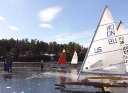
Every local paddler has emphasized that it is common to experience sudden changes in the weather on Lake Champlain. Squalls and summer thunderstorms can develop unexpectedly. Rolling waves of more than 4 feet can develop in the summer and fall. Winds tend to be lowest when paddling in the mornings. Stick close to shore as much as possible.
Valcour and Crab Islands are owned by New York State and managed by the Department of Environmental Conservation (DEC). DEC offers paddling tips at: http://www.dec.ny.gov/outdoor/100898.html. Rules for hiking and camping on State land can be found at: http://www.dec.ny.gov/outdoor/7872.html
Credits
Take the Journey in one of two ways:
1. Navigate to Site 1
2. Listen to our audio tour
Download Lake Champlain Blueway Trail:
Valcour & Crab Islands Audio (.Zip 615.63MB)