Andebit et beaqui corendit, ut quostes esciendion re dit ad et prae parion es quia quas alibus sam, omnim faciden ducipidiat arum autem nobis enis es voat

Blueway Trail: Rouses Point to the Great Chazy River

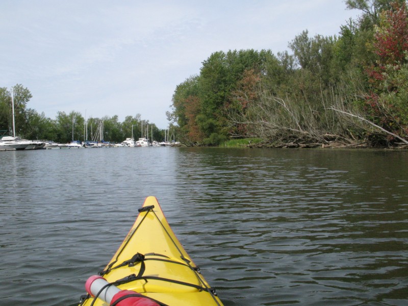
This route starts in the quaint town of Rouses Point and continues down and around the historic and strategic Point au Fer. From here, paddlers have an uninterrupted view down the lake for miles, following a marshy shore. Continuing into Kings Bay, paddlers have the opportunity to observe the abundant wildlife within and around this wildlife management area. The route ends a few hundred feet upstream from the mouth of the Great Chazy River.
Watch this video about the geography of this historic waterway: http://www.lakestolocks.org/content/entry/ltlEF893D4143840DEC2
Learn about the boozy past of Rouses Point with this video: http://www.lakestolocks.org/preview?uid=ltlA1B25268274766E88
Launch Sites: Rouses Point Boat Launch; Great Chazy River NYS Boat Launch
Approximate Paddling Distance: 10 miles (16 kilometers)
Insider Tip from Paddlers Cathy Frank & Margaret Holden: “The Great Chazy River is a lazy river and rapid-free for the first six miles upstream, inviting exploration. It is also stocked regularly with brown trout.”
“From Rouses Point, home of the busiest ports on Lake Champlain until advent of the railroad, to Point au Fer, which the British held after the Revolution, is yet another historic section of Lake Champlain.”
Other Notes: Southern wind can build waves, especially around Point au Fer. This route follows mostly shallow waters.
Activities: 0 hours
Driving: 35 min/15.3 mi
Duration: 1 day
Start at Rouses Point Municipal Boat Launch
Go northeast on Montgomery St
0.28 mi – 00:00:50
Turn right on US-2 and immediately turn left
0.58 mi – 00:02:46
Arrive at Fort Montgomery, on the right
Depart Fort Montgomery
Go back southwest
0.57 mi – 00:02:46
Turn right on US-2 and immediately turn left on Montgomery St
0.57 mi – 00:01:36
Turn left on Lake St (US-11)
1.30 mi – 00:02:50
Turn left on Stony Point Rd (Stoney Point Rd)
0.49 mi – 00:01:15
Arrive at Stony Point Breakwater, on the left
Depart Stony Point Breakwater
Go back northwest on Stony Point Rd (Stoney Point Rd)
0.49 mi – 00:01:30
Turn left on RT-9B (Lake St)
1.60 mi – 00:01:59
Turn left on Point au Fer Rd
1.58 mi – 00:03:48
Arrive at Point Au Fer, on the left
Depart Point Au Fer
Continue northeast on Point au Fer Rd
0.95 mi – 00:02:17
Arrive at Point Au Fer Blockhouse Site, on the right
Depart Point Au Fer Blockhouse Site
Go northwest on Point au Fer Rd
0.04 mi – 00:00:05
Bear left on Scales Rd
0.51 mi – 00:01:13
Turn right on Point au Fer Rd
1.04 mi – 00:02:30
Turn left on RT-9B (Lakes To Locks Psge)
0.18 mi – 00:00:11
Turn left on Kings Bay Rd
0.14 mi – 00:00:41
Arrive at Kings Bay, on the right
Depart Kings Bay
Go back northwest on Kings Bay Rd
0.14 mi – 00:00:41
Turn right on RT-9B (Lakes To Locks Psge)
0.18 mi – 00:00:12
Turn right on Point au Fer Rd
0.46 mi – 00:01:06
Arrive at Kings Bay Wildlife Management Area, on the right
Depart Kings Bay Wildlife Management Area
Go back west on Point au Fer Rd
0.46 mi – 00:01:06
Turn left on RT-9B (Lakes To Locks Psge)
2.29 mi – 00:02:43
Turn left on Lake Shore Rd (CR-22)
1.15 mi – 00:01:50
Arrive at Great Chazy River, on the left
Depart Great Chazy River
Go southeast on Lake Shore Rd (CR-22)
0.19 mi – 00:00:18
Turn left on Laventure Dr
0.16 mi – 00:00:45
Finish at Great Chazy River NYS Boat Launch, on the right


