Andebit et beaqui corendit, ut quostes esciendion re dit ad et prae parion es quia quas alibus sam, omnim faciden ducipidiat arum autem nobis enis es voat

Blueway Trail: Point au Roche to Cumberland Head
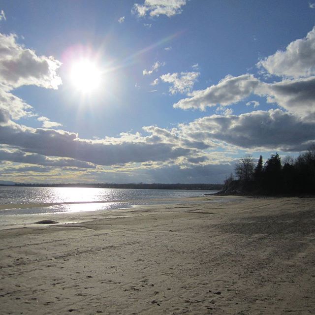
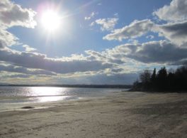
This route passes by the Point au Roche Lighthouse, a testament to the heyday of ship navigation on Lake Champlain. The trail continues along a series of beautiful bays. From almost all of these locations, paddlers have access to the extensive Point au Roche State Park, with its sandy swimming area and trail network.
Launch Sites: Point au Roche NYS Boat Launch; Cumberland Head Ferry Landing
Approximate Paddling Distance: 13 miles (21 kilometers)
Insider Tip from Paddlers Cathy Frank and Margaret Holden: “Give all ferries a wide berth. Most importantly ferries have the right of way. Additionally, kayakers–low to the water–can be difficult to see, especially under wavy conditions.”
Other Notes: While the entire shore of Point au Roche State Park is accessible, there are no stopping points after the park. The western shores of both Point au Roche State Park and Cumberland Head are exposed to north and south winds.
Activities: 0 hours
Driving: 35 min/15.9 mi
Duration: 1 day
Start at Point au Roche NYS Boat Launch
Go south on Dickson Point Rd toward Cemetery Rd
0.12 mi – 00:00:16
Make sharp left on Cemetery Rd
0.11 mi – 00:00:16
Turn right on Point au Roche Rd
0.24 mi – 00:00:23
Arrive at Point au Roche Lighthouse, on the left
Depart Point au Roche Lighthouse
Continue southwest on Point au Roche Rd
0.83 mi – 00:01:20
Turn left on Mooney Bay Rd
0.08 mi – 00:00:11
Arrive at Conner Bay, on the right
Depart Conner Bay
Go back north on Mooney Bay Rd
0.08 mi – 00:00:11
Turn left on Point au Roche Rd
1.32 mi – 00:03:03
Turn left on St Armand Beach Rd (St Armands Rd)
0.26 mi – 00:01:14
Turn left on Middle Bay Rd
0.38 mi – 00:01:48
Arrive at Deep Bay, on the left
Depart Deep Bay
Go back northwest on Middle Bay Rd
0.38 mi – 00:01:48
Turn left on St Armand Beach Rd (St Armands Rd)
0.32 mi – 00:01:33
Arrive at Point Au Roche State Park, on the right
Depart Point Au Roche State Park
Go back north on St Armand Beach Rd (St Armands Rd)
0.59 mi – 00:02:52
Turn left on Point au Roche Rd (CR-22)
1.59 mi – 00:03:50
Turn left on US-9 (Lakes To Locks Psge)
1.80 mi – 00:02:08
Make sharp left on Calkins Rd
0.49 mi – 00:01:11
Turn left on Cooper Dr
0.17 mi – 00:00:24
Arrive at Treadwell Bay, on the right
Depart Treadwell Bay
Go back south on Cooper Dr
0.17 mi – 00:00:24
Turn right on Calkins Rd
0.49 mi – 00:01:11
Turn left on US-9 (Lakes To Locks Psge)
1.93 mi – 00:02:42
At fork keep left on US-9 (Lakes To Locks Psge)
0.06 mi – 00:00:16
Turn left on Commodore Thomas Macdonough Hwy (RT-314 E)
0.95 mi – 00:01:42
At fork keep left on Commodore Thomas Macdonough Hwy (RT-314)
2.95 mi – 00:04:43
Arrive at Cumberland Head Ferry Landing (Cumberland Head, NY to Grand Isle, VT Ferry Crossing), on the left
Depart Cumberland Head Ferry Landing (Cumberland Head, NY to Grand Isle, VT Ferry Crossing)
Go back west on Commodore Thomas Macdonough Hwy (RT-314)
0.12 mi – 00:00:48
Turn left on Lighthouse Rd
0.49 mi – 00:01:10
Finish at Cumberland Head Lighthouse, on the left