Andebit et beaqui corendit, ut quostes esciendion re dit ad et prae parion es quia quas alibus sam, omnim faciden ducipidiat arum autem nobis enis es voat

Blueway Trail: Ticonderoga and La Chute River
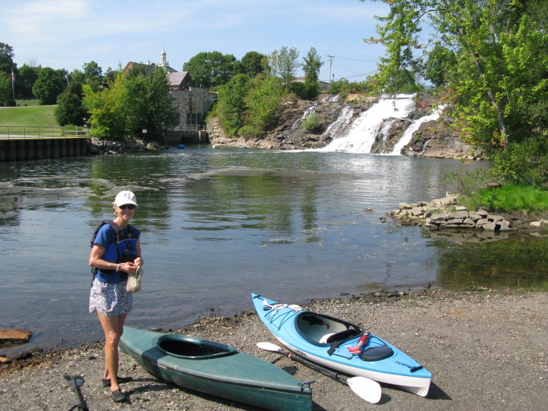
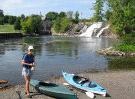
This segment begins by bringing paddlers past the historic Fort Ticonderoga and its impressive grounds. This fort played an important part in the history of Lake Champlain and once held great strategic importance. The trail continues up the La Chute River and ends within a municipal park that includes an interpretive foot path.
Launch Site: Fort Ticonderoga NYS Boat Launch
Take out Site: Bicentennial Park Small Boat Launch
Paddling Distance: 4 miles (6.4 kilometers)
Insider Tip from Paddlers Cathy Frank & Margaret Holden: “When approaching Fort Ticonderoga from the Fort Ti launch site, it is easy to miss the fort altogether if one paddles too close to shore. As we paddled around the bend, we suddenly heard fife and drum music, as if starting just for our arrival. Not being able to see where it was coming from, we paddled out farther from shore and saw the fort for the first time, with a row of cannons pointing our way. It was a thrilling moment.”
Other Notes: Abundant milfoil along shore, can make paddling challenging.
Activities: 0 hours
Driving: 1 hr, 13 min/3.8 mi
Duration: 1 day
Start at Ticonderoga NYS Boat Launch
Go west on RT-74 (Fort TI Rd) toward Sandy Redoubt
0.18 mi – 00:03:24
Make sharp left on Sandy Redoubt
1.01 mi – 00:19:29
Make sharp left to stay on Sandy Redoubt
0.04 mi – 00:00:46
Arrive at Fort Ticonderoga, on the left
Depart Fort Ticonderoga
Go back northwest on Sandy Redoubt
0.19 mi – 00:03:40
Arrive at La Chute River, on the left
Depart La Chute River
Go west on Sandy Redoubt
0.81 mi – 00:15:43
Bear left on RT-74 (Fort TI Rd)
0.48 mi – 00:09:15
Continue on Montcalm St
0.56 mi – 00:10:47
Make sharp right
0.15 mi – 00:02:49
Turn left and immediately turn left
0.05 mi – 00:01:00
Arrive at Bicentennial Falls, on the right
Depart Bicentennial Falls
Go back east
0.05 mi – 00:00:55
Turn right and immediately turn right
0.15 mi – 00:02:54
Bear right on Montcalm St
0.08 mi – 00:01:32
Turn left on Champlain Ave
0.07 mi – 00:01:22
Turn left on Cannonball Path
0.02 mi – 00:00:17
Finish at La Chute River Walk and Bicentennial Park, on the left