
Andebit et beaqui corendit, ut quostes esciendion re dit ad et prae parion es quia quas alibus sam, omnim faciden ducipidiat arum autem nobis enis es voat

Blueway Trail: Ticonderoga to Chubbs Dock
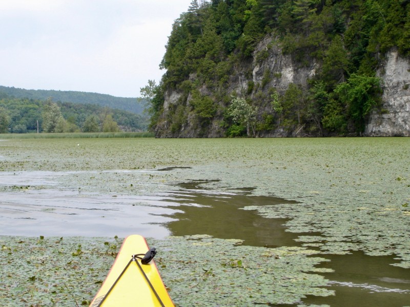
This segment begins by bringing paddlers past the historic Fort Ticonderoga and its impressive grounds. This fort played an important part in the history of Lake Champlain and once held great strategic importance. The trail continues south into the narrowest point in the lake, an area that is surrounded by wetlands and wildlife.
Launch Sites: Ticonderoga Ferry NYS Boat Launch; Chubbs Dock WMA Access
Paddling Distance: 18 miles (29 kilometers)
Insider Tip from Paddlers Cathy Frank & Margaret Holden: “When approaching Fort Ticonderoga from the Fort Ti launch site, it is easy to miss the fort altogether if one paddles too close to shore. As we paddled around the bend, we suddenly heard fife and drum music, as if starting just for our arrival. Not being able to see where it was coming from, we paddled out farther from shore and saw the fort for the first time, with a row of cannons pointing our way. It was a thrilling moment.”
Other Notes: High winds can create chop along this segment, although it is protected from waves. Very limited shore access.
Activities: 0 hours
Driving: 55 min/30.8 mi
Duration: 1 day
Start at Ticonderoga NYS Boat Launch
Go west on RT-74 (Fort TI Rd) toward Sandy Redoubt
0.95 mi – 00:02:15
Make sharp left on Sandy Redoubt
1.00 mi – 00:02:25
Arrive at Fort Ticonderoga, on the left
Depart Fort Ticonderoga
Go back northwest on Sandy Redoubt
0.19 mi – 00:00:27
Arrive at La Chute River, on the left
Depart La Chute River
Go west on Sandy Redoubt
0.81 mi – 00:01:57
Bear left on RT-74 (Fort TI Rd)
0.48 mi – 00:00:53
Turn left on RT-22 (Lakes To Locks Psge)
2.59 mi – 00:03:04
Bear left on Lower Rd (CR-41)
4.45 mi – 00:08:06
Turn left on Hutton Square Rd
0.91 mi – 00:02:12
Arrive at Six Mile Point, on the left
Depart Six Mile Point
Go southwest on Hutton Square Rd
2.04 mi – 00:04:56
Bear left on CR-2 (County Route 2)
0.08 mi – 00:00:10
Make sharp left on CR-3 (County Route 3)
0.70 mi – 00:01:07
Turn left at Best Rd to stay on CR-3 (County Route 3)
0.74 mi – 00:01:11
At fork keep left on CR-3 (County Route 3)
0.88 mi – 00:01:25
Arrive at Mill Bay, on the left
Depart Mill Bay
Go back west on CR-3 (County Route 3)
0.87 mi – 00:01:25
Make sharp left on Lake Rd
2.19 mi – 00:05:17
Turn left on RT-22 (Lakes To Locks Psge)
3.86 mi – 00:04:15
Turn left on Belden Rd
0.19 mi – 00:00:26
Turn right at Manning Rd to stay on Belden Rd
1.32 mi – 00:03:11
Arrive at Pulpit Point, on the right
Depart Pulpit Point
Go back southwest on Belden Rd
1.32 mi – 00:03:11
Turn left at Manning Rd to stay on Belden Rd
0.19 mi – 00:00:26
Make sharp left on RT-22 (Lakes To Locks Psge)
1.17 mi – 00:01:16
Turn left on Leclaire Rd
0.31 mi – 00:00:45
Arrive at The Narrows at Dresden, on the right
Depart The Narrows at Dresden
Go back northwest on Leclaire Rd
0.31 mi – 00:00:45
Turn left on RT-22 (Lakes To Locks Psge)
2.53 mi – 00:02:47
Turn left on Clemons Center Rd
0.04 mi – 00:00:06
Turn left on Lake Rd
0.67 mi – 00:01:37
Finish at Chubbs Dock Landing, on the left


