Andebit et beaqui corendit, ut quostes esciendion re dit ad et prae parion es quia quas alibus sam, omnim faciden ducipidiat arum autem nobis enis es voat

Blueway Trail: Willsboro Bay to the Four Brothers Islands
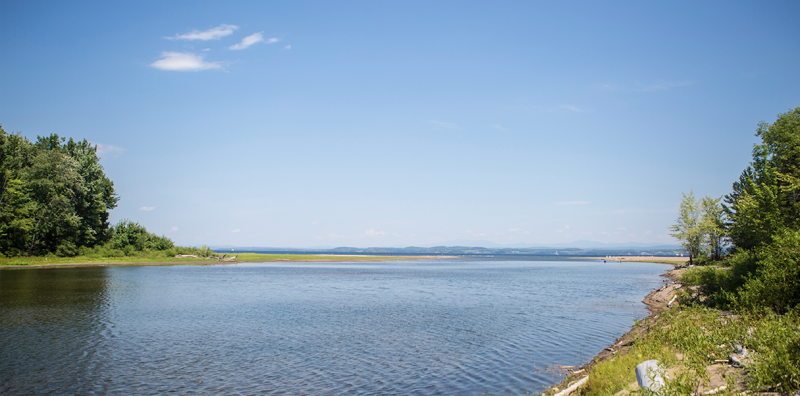
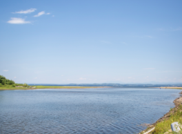
This segment begins in the picturesque Willsboro Bay and take paddlers around Willsboro Point, once a site of many limestone quarries. The trail continues out to the Four Brothers Islands, which offers unparalleled bird watching opportunities. The route ends near the mouth of the beautiful Boquet River, another lively spot for wildlife viewing.
The more ambitious paddlers can choose to hug the western shore of Willsboro Bay on their way out of the bay in order to see the impressive cliffs and clefts up close.
Launch Sites: Willsboro Bay NY Boat Launch; Noblewood Park Canoe and Kayak access
Approximate Paddling Distance: 14.5 miles (23 kilometers)
Insider Tip from Paddlers Cathy Frank & Margaret Holden: “Be prepared for the raucous bird calls as you approach the Four Brother Islands. While the islands are home to mostly cormorants, a variety of gulls and a growing population of Caspian terns also nest here. You might catch a glimpse of black-back gull snagging a Caspian tern chick.”
Notes: This segment should only be done in calm and clear weather by experienced paddlers as the islands are located nearly in the center of the broadest part of the lake, and paddlers will be exposed to wind in all directions. It is also important to stay far enough away from the islands as to not disturb the birds.
Activities: 0 hours
Driving: 47 min/24.3 mi
Duration: 1 day
Start at Willsboro Bay State Boat Launch
Go east on Boat Launch Rd toward Point Rd
0.34 mi – 00:00:49
Turn left on Point Rd (CR-27)
0.37 mi – 00:00:35
Make sharp left on Marina Ln
0.91 mi – 00:02:12
Turn right on Ledge Ln
0.05 mi – 00:00:07
Arrive at Willsboro Bay, on the left
Depart Willsboro Bay
Go back south on Ledge Ln
0.05 mi – 00:00:07
Turn left on Marina Ln
0.91 mi – 00:02:12
Turn left on Point Rd (CR-27)
0.34 mi – 00:00:32
Make sharp left on Frisbie Rd
0.58 mi – 00:01:24
Turn left on Lilly Ln
0.40 mi – 00:00:57
Arrive at Frisbie Point, on the right
Depart Frisbie Point
Go back east on Lilly Ln
0.40 mi – 00:00:57
Turn right on Frisbie Rd
0.58 mi – 00:01:24
Turn left on Point Rd (CR-27)
1.82 mi – 00:02:55
Bear left on Sabousin Dr
0.07 mi – 00:00:10
Turn right at Hatch Way to stay on Sabousin Dr
0.69 mi – 00:01:39
Continue on Cayuga Pl
0.15 mi – 00:00:21
Make sharp right on Sabousin Dr (Corlear Dr)
0.14 mi – 00:00:20
Arrive at Willsboro Point, on the right
Depart Willsboro Point
Go back southwest on Sabousin Dr (Corlear Dr)
0.14 mi – 00:00:20
Make sharp left on Cayuga Pl
0.15 mi – 00:00:21
Continue on Sabousin Dr
0.69 mi – 00:01:39
Turn left at Hatch Way to stay on Sabousin Dr
0.07 mi – 00:00:10
Bear right on Point Rd (CR-27)
2.69 mi – 00:04:19
Turn right on Farrell Rd (CR-62)
2.06 mi – 00:02:36
Turn left on RT-22 (Lakes To Locks Psge)
2.36 mi – 00:05:11
Turn left on Noblewood Ln
0.28 mi – 00:00:41
Arrive at Boquet River, on the left
Depart Boquet River
Continue east on Noblewood Ln
0.16 mi – 00:00:22
Arrive at Boquet River Delta, on the left
Depart Boquet River Delta
Go back west on Noblewood Ln
0.34 mi – 00:00:49
Turn right on RT-22 (Essex Rd)
2.44 mi – 00:04:20
Arrive at Noblewood Park, on the right
Depart Noblewood Park
Go back southeast on RT-22 (Lakes To Locks Psge)
0.05 mi – 00:00:07
Turn left on Farrell Rd (CR-27)
0.16 mi – 00:00:14
Turn right on Point Rd (CR-27)
1.01 mi – 00:01:37
Turn right on Dugan Way
0.34 mi – 00:00:49
Continue
0.09 mi – 00:00:26
Arrive at Flat Rock Camp, on the right
Depart Flat Rock Camp
Go back southwest
0.09 mi – 00:00:26
Continue on Dugan Way
0.34 mi – 00:00:49
Make sharp right on Point Rd (CR-27)
2.61 mi – 00:03:40
Turn right on Ligonier Way
0.26 mi – 00:00:36
Continue
0.18 mi – 00:00:52
Arrive at Ligonier Point, on the right
Depart Ligonier Point
Finish at Four Brothers Islands