
Andebit et beaqui corendit, ut quostes esciendion re dit ad et prae parion es quia quas alibus sam, omnim faciden ducipidiat arum autem nobis enis es voat

Cook Mountain Preserve
Cook Mountain was purchased in 1876 by George Delano. George fought in the Civil War, where he was wounded in the raid at Harper’s Ferry. After attending business school and then running a diner in Poughkeepsie, George moved to the northern end of Lake George to farm the slopes of Cook Mountain. He maintained a “sugar bush” for maple syrup and two apple orchards, shipping the fruit to New York City.
The Cook Mountain Preserve was established in 1990 through the generation donation of 176 acres by Donald and Marjorie Delano, George’s grandchildren. In 1995, the preserve was expanded by an 18-acre addition donated by Dr. and Mrs. George Boyle. The preserve harbors a variety of habitats, from moist wetlands and overgrown farmland to mixed hardwood/coniferous forest and dry rocky-summit grassland. Remnants of stone walls run up the mountain’s slope, reminders of how different Cook Mountain and the land surround Lake George looked when cleared for farms at the turn of the century.
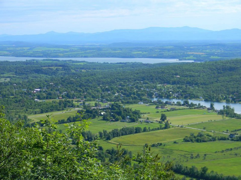
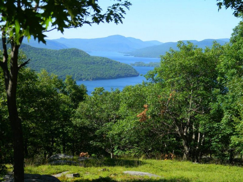
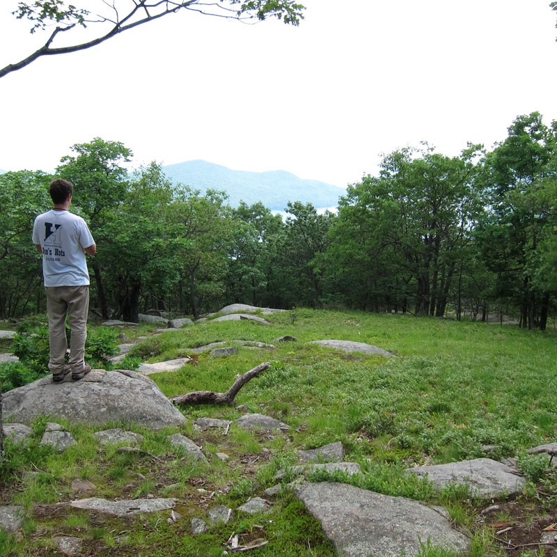
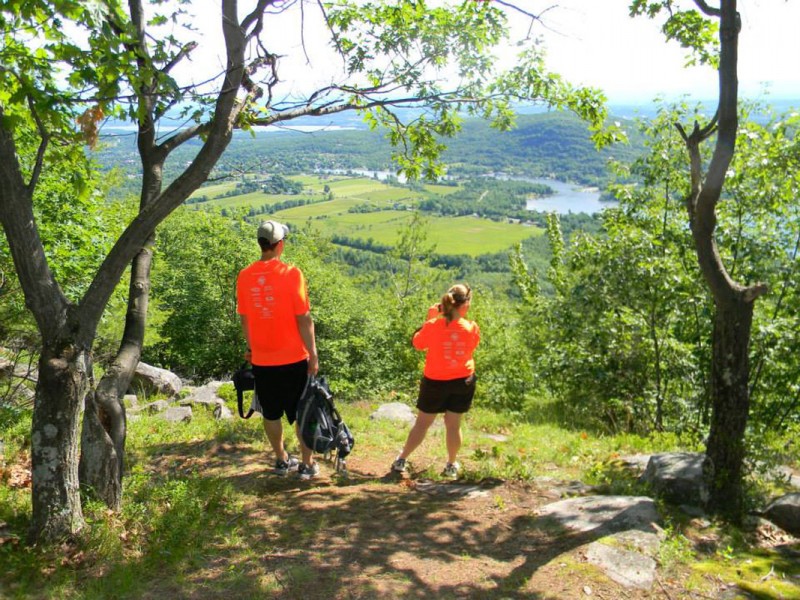
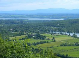
Cook Mountain’s open ridge provides exquisite views of northern Lake George, the Champlain Valley, and Vermont’s Green Mountains. The one and one-half mile Summit Trail passes through a variety of habitats from moist wetlands and overgrown farmland to mixed hardwood/coniferous forest and dry rocky-summit grassland. Remnants of a beaver lodge and dams, as well as rare wetland plants, such as Hill’s pondweed, can be spotted on the lower portions of the trail. From the rocky summit, you can enjoy an expansive view of northern Lake George with minimal shoreline development and imagine how the lake’s water quality would be compromised if these forests harbored buildings rather than trees, wildflowers, birds and other important creatures.
Distance And Terrain
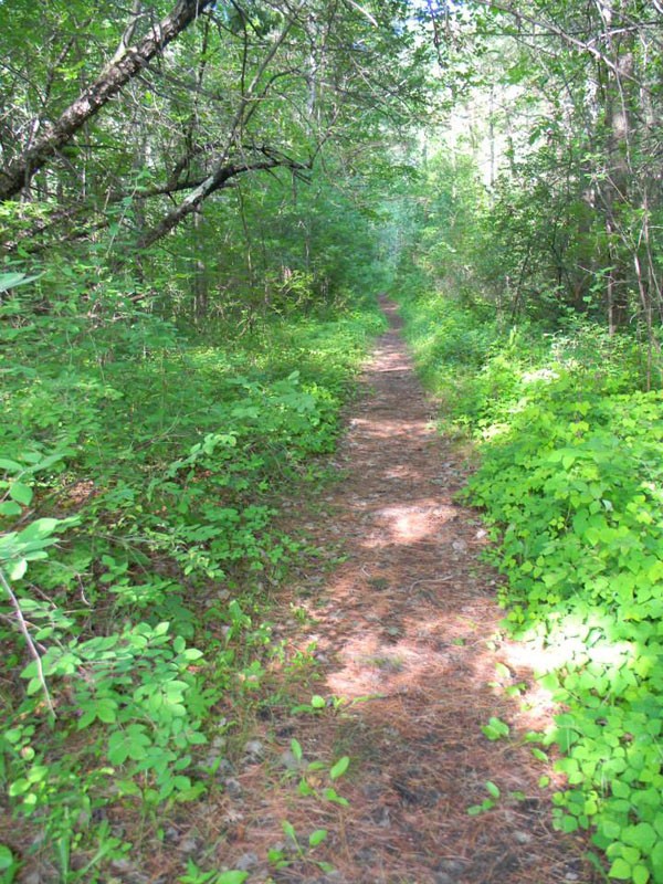
The three trails of Cook Mountain Preserve offer a variety of experiences for hikers of all ages and abilities. It is 2 miles of easy and challenging trails with scenic views of Vermont, and Lake George with snowshoeing in the winter.
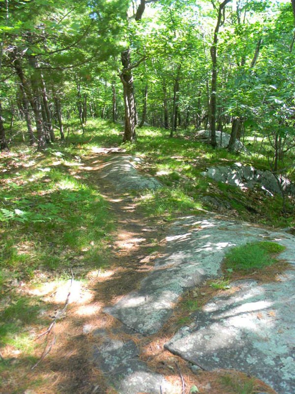
Starting from the parking area and kiosk, the yellow trail follows a wide flat path into the preserve. After about 0.12 miles the trail’s loop begins. Stay straight to follow the trail another 0.4 miles along a gently climbing path (which turns into a dirt road) to its junction with the Ridges Trail, or turn right to wind along the shore of what was once an active beaver pond. The absence of beavers resulted in a breached dam and loss of water; grasses and shrubs recolonized the pondflat, and it is slowly returning to woodland. After about 0.2 miles, the trail joins the Ridges Trail, marked with red round disks.
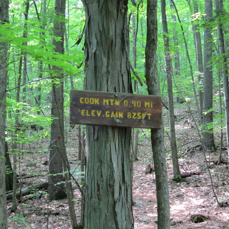
The Ridges Trail ascends steeply – 680′ over 0.5-mile – then climbs more gradually for the remaining 0.6 miles to an elevation of 1,213′. A short loop to an eastern view into Vermont is reached after 0.75 miles from its base. Continue following The Ridges Trail to its end for a fantasic, clear view down Lake George. Flat Rock and Anthony’s Nose can be seen on the left, and Roger’s Rock on the right.
Highlights And Key Points Along The Route
For history buffs, there is a short blue trail that takes you to a cemetery that dates to the Civil War. It is reached from the yellow trail about 0.15 miles past the beginning of the loop. Also watch for stumps and old beaver chew marks on the trees you walk along the old railroad bed that passes through the lower portions of the preserve. Plants such as calico aster, Queen Ann’s lace, and golden rod are characteristic of a successional beaver meadow.
Identify And Describe The Management Organization
The Lake George Land Conservancy (LGLC) is a not-for-profit land trust that works solely within the Lake George watershed in the southeastern corner of New York’s Adirondack Park.
Additional Notes
Cook Mountain Preserve is open year-round, dawn to dusk.
Please stay on the marked trails.
Please be courteous of other preserve guests.
No removal of plants or animals without permission.
No camping, littering or fires.
Motorized or non-motorized recreational vehicles are NOT allowed.
Leashed dogs are permitted. Please clean up after your dog.
Off-street parking is available but limited. Please use caution when parking and be mindful of traffic.
Fees
no
ADA Accessible
no
Tours Are Offered
no
Site is Child-friendly
yes
Site is Pet-friendly
yes
Location
Downloads
NearBy
-
Protect Lake George: Stop Aquatic Hitchhikers
-

Snug Harbor Marina
-
Dam and Walkway at Lake George Outlet at Ticonderoga
Lake George Land Conservancy
518-644 9673
4905 Lake Shore Drive
PO Box 1250
Bolton Landing, NY 12814 US
[email protected]


