
Andebit et beaqui corendit, ut quostes esciendion re dit ad et prae parion es quia quas alibus sam, omnim faciden ducipidiat arum autem nobis enis es voat

The Climber
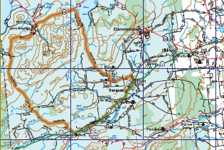
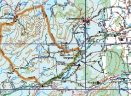
This route involves some strenuous climbing around 3,820’ Lyon Mountain, the highest point in Clinton County and through some of the most sparsely settled areas in the county. Shortly after the Saranac Town Hall the first climb Russia (pronounced Roo-sha) Hill begins, a 1 mi. climb. About halfway up the hill there is a 1⁄4 mile dirt road leading to a parking lot at the top of High Falls Dam with a nice view. The last store for 1 5 miles is in Clayburg about 1/4 mi. before the Climber turns onto Standish Rd. and starts the major climb. In Standish the route takes a sharp right turn toward the hamlet of Lyon Mtn. and climbs for about 3/4 mi. to the high point, 1989 ft. Just before entering Lyon Mtn., there is a public spring.
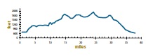
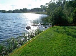
Chazy Lake can be seen at a number of points south of Rt. 374. and at mile 33 the trip becomes all downhill. There is a great view of the Saranac Valley just before Nashville Rd. where Chazy Lake Rd. turns right for the downhill to Pickett’s Corners.
Difficult
0.0 L out of Saranac Elementary parking lot.
0.2 R on Route 3.
7.7 R on Standish Road at Clayburg (last store until Lyon Mountain).
12.3 High Banks – True Brook Road to the right is a rough short cut return.
18.1 Road turns right in Standish.
22.3 R on Route 374.
28.0 R on Chazy Lake Road.
35.4 L at intersection with Clark Hill Road (still Chazy Lake Road).
37.7 L on Ganong Drive.
38.0 Saranac Elementary School. Fees
no
Tours Are Offered
no
Related Sites Or Experiences
NearBy
Lake Champlain Bikeways
802-652-BIKE
c/o Local Motion Trailside Center
1 Steele St. #103
Burlington, NY 05401 US
[email protected]


