
Andebit et beaqui corendit, ut quostes esciendion re dit ad et prae parion es quia quas alibus sam, omnim faciden ducipidiat arum autem nobis enis es voat

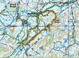
Water’s Edge Trail
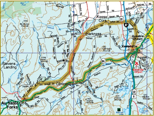
0.0 R out of Grand Union parking lot in Ausable Forks onto Rt. 9N.
11.3 Enter Keeseville, continue to traffic light.
11.5 At traffic light at four corners, turn L onto Rt. 22 to return to Ausable Forks.
11.9 R onto Grove St. at top of hill (no sign but across from Elementary School – becomes Chasm Rd.)
13.6 Straight on Chasm Rd past apple orchard.
14.0 L at stop intersection onto Arthur Rd.
14.6 Straight through Rt. 22 intersection.
16.2 R at stop intersection onto Union Rd.
16.3 At next intersection, turn L onto Harkness Rd.
18.6 Through intersection onto Clintonville Rd.
22.2 Stay straight onto Dry Bridge Rd.
25.2 Bear L onto Golf Course Rd.
27.2 Through stop intersection to downtown Ausable Forks.
27.3 Grand Union parking lot.
Alternate Route to Port Kent Ferry
11.5 At traffic light at four corners, turn R onto Rt. 22 to downtown Keeseville.
13.5 R onto Rt. 373.
16.7 Port Kent ferry dock to Burlington, VT and Amtrak stop.
Location
Related Sites Or Experiences
NearBy
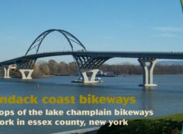
Lake Champlain Bikeways
802-652-BIKE
c/o Local Motion Trailside Center
1 Steele St. #103
Burlington, NY 05401 US
[email protected]


