Andebit et beaqui corendit, ut quostes esciendion re dit ad et prae parion es quia quas alibus sam, omnim faciden ducipidiat arum autem nobis enis es voat

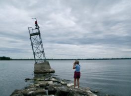
Stony Point Breakwater


The Stony Point Breakwater is 2,000 feet long. It was completed after years of budget problems in 1893, at a cost of $98,500. The breakwater was constructed to protect Rouses Point harbor from southern winds and storms.
In 1836, this point was to be the site for a major U.S. fort that would guard the Champlain waterway; there are engineering plans in the U.S. Archives for this structure. Two forts, the other to be built on Windmill Point, were proposed. Early stone came from a stone quarry located on the shore nearby. The small stones deposited here by wave and ice were used for town roads for many years. The breakwater marks the southern end of the Historic Landing District of the Port of Rouses Point.
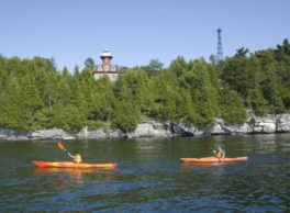
Insider Tip from Paddlers Cathy Frank and Margaret Holden: “On the Stony Point Breakwater, you will see fossils similar to those found at Fisk Quarry and Goodsell Ridge on Isle La Motte, Vermont, which is probably where some of this rock came from.”